Other ship types (Offshore) · Norway flag · built 2011
SERVER TIDE: CO₂ emissions 2025
IMO 9591856 MMSI 259961000EU ETS
- CO₂ reported 2025
- 6,099 t
- Fuel burned
- 1,902 t
- Time at sea
- 4,786 h
- Emitted at berth
- 12% of total
- Share of year under way
- 55%
- Gross tonnage
- 4,590

SERVER TIDE against its type
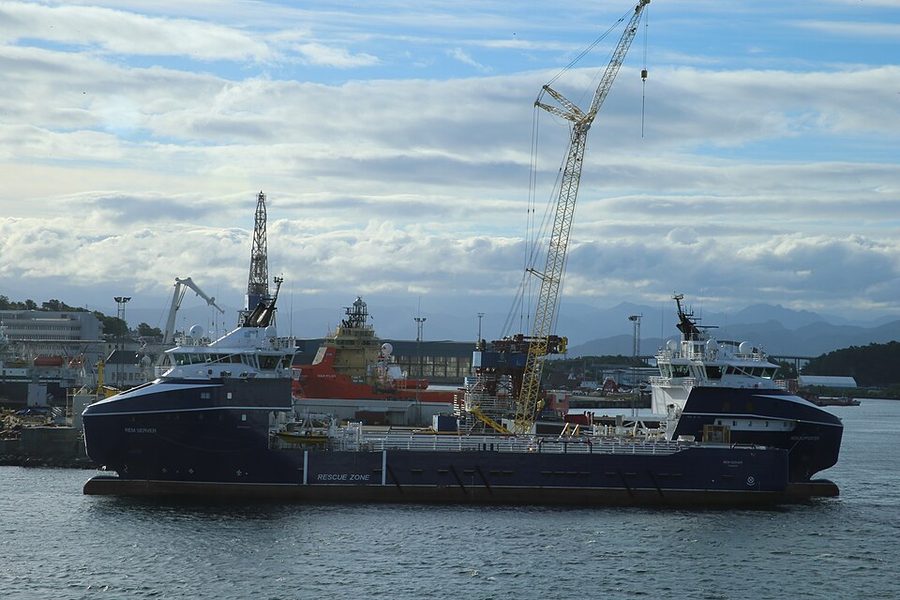
Built in 2011, it is the same age as the median offshore vessel on this register (build year 2011, 410 vessels with a known build year). At 4,590 gross tonnage it is larger than 57% of the other 396 offshore vessels with a recorded tonnage. It is one of 70 offshore vessels here under the Norway flag, 16.9% of the 413 on the register. The same builder is recorded for 13 other vessels here, 10 of them offshore vessels.
Its 6,099 t of CO₂ for 2025 is 1.5 times the median of 4,049 t among the 390 offshore vessels on this register that reported for 2025. Per nautical mile it emitted 255.9 kg CO₂, 27% below the type median of 348.3 kg. It logged 4,786 hours at sea against a median of 3,550 hours for its type that year. 12.1% of its 2025 emissions were at berth; the median for offshore vessels was 6.4%. Of the 6 sister ships listed below with a 2025 return, 1 reported a lower CO₂ per nautical mile than this vessel.
Emissions by year2025–2025
| Year | CO₂ (t) | Fuel (t) | Distance (nm) | At sea (h) | At berth (t) | kg CO₂/nm | EEOI | Percentile |
|---|---|---|---|---|---|---|---|---|
| 2025 | 6,099 | 1,902 | — | 4,786 | 738 | 255.9 | — | — |
Vessel particulars
- IMO number
- 9591856
- MMSI
- 259961000
- Call sign
- LCLU
- Ship type
- Other ship types (Offshore)
- Gross tonnage
- 4,590
- Length overall
- 94.0 m
- Beam
- 20.0 m
- Year built
- 2011
- Flag state
- Norway per EU MRV 2025
- Builder
- Langsten Slip & Båtbyggeri
- Port of registry
- SANDNES MRV 2025
- Verifier
- DNV, Germany
- Accreditation
- VS-16026-01
- Compliance document issued
- 2026-06-15
- Compliance document expires
- 2027-06-30
Where the 2025 emissions occurred
Methane, nitrous oxide and EU ETS2025
- Total CO₂ equivalent
- 6,192 t
- Methane (CH₄)
- 0.10 t
- Nitrous oxide (N₂O)
- 0.34 t
- Under EU ETS
- 6,099 t, 100% of total
Observed movementsAIS · Norwegian waters
- First seen
- 03 Jul 2025
- Last seen
- 02 Jul 2026
- Days observed
- 260
- Positions
- 16,329
- Median speed
- 9.8 kn
Its recorded positions span 58.0°N to 59.0°N and 4.5°E to 6.6°E.
400 hourly points from 16,329 positions. Filled circle first, open circle last; squares are ports for orientation, not calls.
Positions recorded per month
Norwegian Coastal Administration open AIS, Norwegian waters only, 01 Jul 2025 to 27 Jul 2026. A gap means the vessel was not recorded here, not that it was idle or that a transponder was off.
Sources and how to read this
- Emissions: EU MRV publication (THETIS-MRV), reporting years 2025–2025, published by the European Commission.
- Vessel particulars: Wikidata (CC0) and Wikimedia Commons.
- Movements: Norwegian Coastal Administration open AIS extract.
This page draws on 1 MRV reporting year, 5 of 5 vessel particulars, AIS movements in Norwegian waters and a licensed photograph. Not found in the sources for this vessel: an efficiency ranking, a name history, a sanctions listing and US port state inspections.
Empty means unreported, never zero. How EEOI, distance, percentiles and sister ships are handled is explained under reading a vessel page. Something wrong? See corrections.